Ask people today, and they’d be quick to tell you exactly what a GPS is and when it’s used. Compare that to twenty years ago when GPS was merely three letters of the alphabet and everyone used a paper map to find their destination. However, despite the leap in technological advancements since then, most people don’t know how GPS technology is transforming the construction industry—especially on earthmoving sites. Let’s discuss how GPS systems have revolutionized earthmoving and the different types used on job sites.
GPS & Construction

For contractors who invest in GPS systems, the gains in productivity, accuracy, and speed are massive. In simple terms, GPS systems on construction sites receive the same satellite positioning signals used in other navigation systems, but with an elevated feature: broadcasted radio corrections received via on-site GPS base stations. These corrections allow rovers and machines in the field to make accurate earthmoving decisions that match a digital topographic plan.
Now, let’s step back and look at what exactly a machine-control GPS does.
Machine-Control GPS

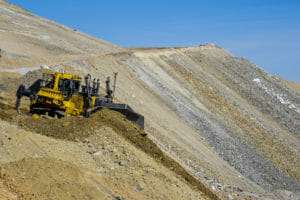
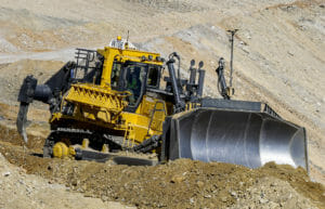
Machine-control GPS systems assist machines like motor graders, dozer, scrapers, compactors, and hydraulic excavators by enhancing efficiency. The primary benefit of using these systems is removing the need for grade stakes. In fact, according to GPS suppliers, 90 percent of stakes are typically eliminated when using a machine-control GPS system. This, in turn, lowers cost by cutting downtime and reducing the cost of stake replacement.
Not only do machine-control GPS cut costs, but increases productivity, as well. By increasing the chances of successes through automating the exact grade information and positioning, the potential results of operator productivity increases and the need to rework incorrect grades goes down.
Benefits of Using GPS Systems

Combining your construction efforts with GPS systems has a variety of benefits. These include:
– Maximizes equipment productivity
– Makes earthmoving jobs easier to plan
– Easily adjust filed operations as needed
– Minimizes delays
– Revised surface files of excavated areas help keep plans up-to-date
– Out-compete other bids by lowering costs
– Reduces safety risks
For more information about how Wollam Construction uses GPS systems on their projects, contact one of our team members today.


